PM unveils political map of Pakistan
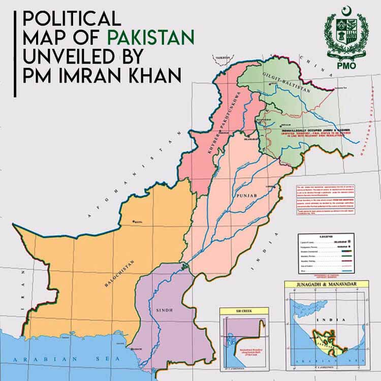
Islamabad: Prime Minister Imran Khan Tuesday unveiled a political map of Pakistan at a ceremony here, saying the whole political leadership of the country, Federal Cabinet and the Kashmiri leadership fully endorsed it.
Speaking on the occasion, he said the new map clearly showed the Indian Illegally Occupied Jammu and Kashmir (IIOJK) as a disputed territory whose fate should be resolved only through implementation of the United Nations Security Council resolutions, guaranteeing the Kashmiris their right to self-determination.
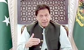
Terming it a historic day in the country’s history, he said the only resolution to the IIOJK issue should be sought out in accordance with the UNSC resolutions, sentiments of the Pakistani nation and the Kashmiri people.
“Once again, we clearly tell the world that the only resolution to the IIOJK issue is political as there is no other way,” he said, denouncing the Indian government’s illegal action of August 5 last year which clearly negated the UNSC resolutions and the international laws.
The members of the Federal Cabinet were present during the ceremony televised live by Pakistan Television Corporation.
The prime minister said the new map reflected the sentiments of Pakistani nation, the principled stance of Kashmiris for their just right to self-determination and clear negation of the illegal annexation by the Indian government.
The prime minister regretted that the UNSC resolutions, which had clearly assured the Kashmiri people to exercise their right to self-determination, had not been implemented so far.
He also reassured the nation and the Kashmiri people that his government would continue highlighting the issue forcefully at all global fora.
The IIOJK issue would be resolved soon and the map was a step towards that destination, he added.
The prime minister said nurturing of ideas always led to the achievement of goals and cited his cricket career, which led the Pakistan team to win the World Cup, helped him construct the Shaukat Khanum Memorial Hospital and led the Pakistan Tehreek-I-Insaf party to power.
Speaking on the occasion, Foreign Minister Makhdoom Shah Mahmood Qureshi said the whole nation, the Kashmiri people and especially the prime minister deserved felicitation because for the first time a political map of the country clearly showing its borders was approved by the Federal Cabinet with complete backing of all the political parties.
Previously such a map was limited to closed doors only, but for the first time, it was openly brought before the world, he added.
The map reflected the true sentiments of the Pakistani nation and rejection of Indian government’s August 5 last year illegal steps, he said, adding the Indian government mocked its own people by presenting a false map of the country after illegal annexation of the internationally recognized disputed territory of IIOJK.
The foreign minister said all the political leadership, government of Pakistan and the Kashmiri leadership outrightly rejected those illegal moves as the IIOJK had been a disputed territory and required resolution in accordance with the desires of the Pakistani nation, the Kashmiri people and the UNSC resolutions.
Qureshi maintained that the map had clearly removed any confusion about the international borders.
The red dotted line in the map clearly indicated that it required resolution, he added
The foreign minister said Siachen belonged to Pakistan as a part of it was illegally occupied by India, whereas the country’s map clearly defined all its borders.
He further said that Sir Creek was also a part of Pakistan where India tried to occupy the area with machinations.
The foreign minister said in the new map, the erstwhile Federally Administered Tribal Areas were now merged into Khyber Pakhtunkhwa province, with clear borders with Afghanistan.
He said the Pakistani nation fully backed the Kashmiris’ struggle for just resolution of the dispute in accordance with their desires.

