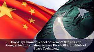
China-funded RS &GISc starts at IST with maximum participation

Islamabad: China-funded five-day Summer School on Remote Sensing and Geographic Information Science (RS &GISc) commenced at Institute of Space Technology (IST) with participation of maximum number of students and professionals here.
The summer school is being organized by The National Center of GIS and Space Applications (NCGSA), a project of the Higher education Commission of Pakistan in collaboration with the Deqing Association for Geospatial Information Professionals, China.
The program is being supported under the framework of The Belt and Road International Geospatial Information Training Center, China.
The Summer School, being from June 19-23, offers an immersive and enriching experience for both students and professionals alike through special sessions thoughtfully curated by a panel of national and international experts.
The Summer School on RSGISc aims to provide a comprehensive overview of the fundamental concepts and practical applications of remote sensing and GIS technology.
This intermediate-level school is specifically designed for researchers, academics, professionals, and students working in the areas of Remote Sensing and Geographic Information Science, seeking to advance their skills and deepen their understanding of the subject matter.
The participants will have the opportunity to learn from esteemed subject matter experts from Pakistan and China.
The 5-day summer school will cover a diverse range of topics, including the principles of remote sensing, digital image classification, spatial analysis, geodatabases, cartographic design, mapping, and more.
In addition, the participants will be introduced to cutting-edge advancements in the field, such as Google Earth Engine analysis, Microwave Remote Sensing techniques and applications, and Machine Learning and AI in Remote Sensing and GIS.
The opening day of the summer school featured distinguished speakers who shed light on various aspects of remote sensing and geographic information science.
Han Ni and Dr. Najam Abbas Naqvi, Chairman of the National Center of GIS and Space Applications (NCGSA), delivered the opening session, setting the tone for an exciting and knowledge-packed week ahead.
Dr Saleem Ullah from IST provided insights into the fundamentals of remote sensing and its applications, while Dr. Muhammad Shakir from IST discussed the fundamentals of Geographic Information Science and its applications.
Moreover, Dr Najam Abbas Naqvi explored the fundamentals of Global Navigation Satellite Systems (GNSS) and their applications.
Lastly, the participants were enlightened with an introduction to Microwave Remote Sensing and its applications by Professor Dr Keren Dai from Chengdu University of Technology, China, who joined the program in an online session.
Dr Sajid Ghaffar form IST concluded the day with a discussion on the fundamentals of Photogrammetry and its applications.
The Summer School on Remote Sensing and Geographic Information Science is set to deliver an enriching experience, comprising engaging lectures, hands-on exercises, and stimulating group discussions.
With the participation of over 100 professionals and students, this educational journey will provide practical skills and theoretical knowledge to enhance their proficiency in the field.
Supported by a team of 20 esteemed resource persons from Pakistan and China, this collaborative learning environment promises to empower participants with valuable insights and expertise in Remote Sensing and GISc.


