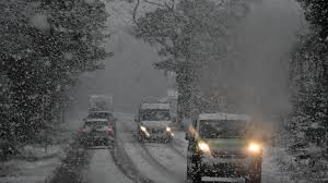
UK snow and ice warnings as weather turns colder

London: Snow and ice warnings have been issued by the Met Office for late Sunday through to Tuesday.
Northern areas and higher ground will be most at risk for potentially disruptive snow.
Temperatures will be below the November average by Sunday with frosts expected through the coming week.
BBC weather graphics with the left hand image showing a yellow weather warning across northern Scotland for snow and ice for Sunday evening. On the right hand side a yellow weather warning for northern England and southern Scotland for snow and ice on Monday and Tuesday.
As colder Arctic air moves southward across the UK over the weekend, wintry showers will start across northern Scotland on Sunday afternoon.
The Met Office warn that around 5-10cm of snow could settle on higher ground in northern Scotland into Monday morning with 1-3cm possible to lower levels.
Along with falling temperatures overnight into Monday, this will also bring the risk of ice.
Arctic air also tends to be cleaner so with some clear skies on Sunday night, there could be a good chance of seeing the Leonid meteor shower.
A weather system will push in from the Atlantic on Monday and this is where there could be some uncertainty in the forecast.
While rain is expected across much of England and Wales, there will be some snow falling on the northern boundary of this area. Higher ground in Northern Ireland, northern England and southern Scotland will be most likely to see snow .
Met Office yellow warnings have been issued on Monday and Tuesday for northern England and southern Scotland.
Over the high ground of the Pennines, there could be 15-20cm of snow accumulating and possibly causing some disruption.
Towns and cities at lower elevations also have a risk of disruptive snow, perhaps 2-10cm in places, but this will depend on the precise track of the rain moving across the UK – the heaviness of the precipitation and the elevation of the land.
As we are still in mid-November, the ground remains relatively warm and therefore it will be harder for snow to settle at low-levels.
Snow showers will continue to fall in Northern Scotland on Monday and Tuesday.
Snow showers likely to continue through the week, especially on higher ground. The cold spell looks set to last for about a week in some areas.
There will be plenty of bright and sunny conditions with morning frosts but we’ll also see wintry showers at times.
Heavier showers around Scotland and northern England, will continue to bring a risk of some snow especially over higher ground.


